36 Hours in the Yorkshire Dales: The Best Hike and Places to visit
- karenconnolly59
- Jul 22, 2025
- 8 min read
Updated: Mar 28
"The Path Reveals Itself Once You Start Walking"

The Yorkshire Dales is one of the most scenic areas in England. It offers everything you could wish for a spontaneous night away, with stunning hikes and breathtaking views around every corner.
It was Saturday night, and we had planned a walk for Sunday. The question arose: "Should we stay over and have a cheeky night away?" Being retired gives us flexibility in our choices, so we thought, "Why not?" Out came the Airbnb.com and Booking.com apps. Within five minutes, we found a place to stay. After packing our overnight bags, we settled in for Saturday night, setting our alarms to leave around 8-9am on Sunday. Normally, we would consider staying in our Ineos Grenadier, but honestly, getting the bed out and sorting the bedding for just one night felt like too much trouble. A reasonably priced BnB was our answer.
Now, let's get into where we chose to stay, why we chose it, and how it was! This is just one suggestion; there are entire books written on the Yorkshire Dales. One excellent example is The No Fuss Travel Guide - Road Trip Yorkshire by Robbie Roams.
36 Hours in the Yorkshire Dales: The Best Hike and Places to Visit
If you only have a day, you should definitely include Malham, a small village in the Yorkshire Dales on the Pennine Way, for your taste of the Dales.
Why Malham?
Malham was originally mentioned in the Domesday Book as Malgun, which describes "a settlement by the gravelly places." It has been inhabited for over 1,000 years. You can see traces of the Iron Age and how the industry has changed from mills and mines to hill farms and tourism. The population of Malham is about 220 people.
The Yorkshire Dales consist of glacial valleys and exposed moorland, predominantly made of carboniferous limestone. The seven main rivers in the area provide different catchment areas: Aire, Lune, Nidd, Ribble, Swale, Ure, and Wharf. The limestone is clearly visible in the dry stone walls and in the gorges carved by the Ice Age, such as Gordale Scar and the impressive amphitheatre-like escarpment of Malham Cove. Located in the Pennines, the Yorkshire Dales extend to Cumbria and Lancashire but remain within the historic boundaries of Yorkshire and, since 1954, within the Yorkshire Dales National Park.
Hiking is very popular in the Yorkshire Dales, with several well-known hikes and public rights of way, such as the Dales Way, the Pennine Way, the Coast to Coast long-distance route, and the Yorkshire 3 Peaks. These hikes are generally for those who have hiked before and are used to climbing and achieving elevations above 1,000 feet. We chose to start with a shorter distance and an elevation gain of less than 1,000 feet. The Malham Cove Landscape Trail fit the bill nicely.
Where to Start
When arriving in Malham, we suggest doing this hike on a weekday. At the weekend, the village becomes very busy, and parking is more expensive. We paid £8 to park all day in the village car park (a field opposite the visitor centre) since we arrived on a Sunday. It was £6 in the visitor centre car park, or if you park on the road during the week, you can make a donation into the milk churns dotted around the village. The funds raised from parking are used to improve the village, so we didn't mind the £8 as it was being used purposefully. We think the village could quickly become spoiled by tourists.


The hike we suggest is a circular route that takes in the main sights. It is just under 5 miles (8 km) long, with an elevation gain of 820 feet (250m). We recommend taking the anticlockwise route, as this way you avoid climbing 400 steps and can enjoy a panoramic view of Malham Cove appearing before your eyes across the field.
Janet's Foss
Starting at the visitor centre, cross the road, go around the side of the building opposite, then cross the stream over an iron and York Stone bridge, and head for Janet's Foss. It is well signposted. As you step off the bridge, turn right and follow the well-laid-out footpath.


From here, directions are not needed. Just take the path through the fields along the limestone walls and the river, through some woodland until you reach the waterfall called Janet's Foss. On a warm day, you may see people bathing, and you might wish to take a dip too. We didn't, as this hadn't been in our spontaneous plan 😂, so we just admired those who did and carried on.


Leaving at the left side of the waterfall, there is a short climb between the rocks, which can be very slippery even with walking boots or shoes, so take your time and don't hesitate to ask for help if needed. I had to put my camera down and use both hands to steady myself while climbing the rocks. You then follow the path again until you reach a layby selling food with a couple of tables. It's at this point you can choose which way to go.
Gordale Scar
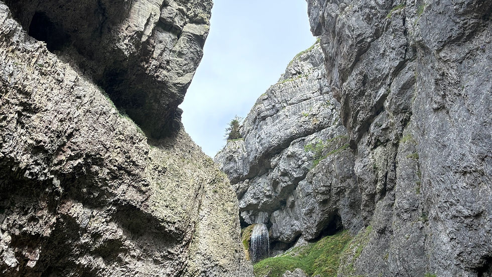
If you carry on a short way after the layby, you will reach a gate with a path to the left. Pass through the gate and follow the path, as it only leads to one place: Gordale Scar. You will walk alongside the meandering river until you reach a rock face where the path curves around the base. As you turn the corner, it's an 'Oh WOW' moment as the great ravine appears before you, and you see the waterfalls spilling onto the huge boulders below. This ravine or gorge was produced by the melting ice from the Ice Age some 3 million years ago.

Some people were adventurously climbing the rocks up to the first waterfall, but most stood at the bottom, marveling at the height of the rocks.
From here, you walk back along the path with the river now on your right until you pass through the gate, turn right, and reach the food truck or layby again.

Malham Cove
Behind the layby is the signposted path for Malham Cove, which quickly becomes a flight of steps ascending the hillside.

There is really only one way to go at the top of the steps. Keep to the path, cross fields, and reach a point where you bear left through a swing gate. Then cross over a set of steps over the limestone wall. At this point, you are not far from the limestone structure everyone is talking about.

As you cross the last field, you suddenly see Malham Cove come into view, and it is breathtaking. You have to make your way down the hillside before you reach the giant pavement, so take care as the rocks protrude from the grass, and some are slippery.
The giant pavement looks like a jigsaw puzzle of rock where the pieces have not yet been slotted together. There are indentations formed from pools of water and large crevices that could certainly sprain your ankle if you slipped in between. I took it really slowly here and took nothing for granted, as some of the rocks were surprisingly loose underneath too.

At the top, just pause in amazement and look out to the valley below, knowing that where you are standing was once where the meltwater from the last glacier, over 12,000 years ago, cascaded over the 260 feet (80m) drop to the basin. The width of the water was 984 feet (300m), and because the lip of the rock was more heavily eroded than the sides, it caused the rock to curve like an amphitheatre.

There hasn't been a waterfall here since 1824, except once in 2015. The heavy rainfall in Storm Desmond caused water to fall over the top on 6th December for a few hours. It made it the highest single-drop waterfall above ground in England for that short time.
As you cross the pavement, you can look out to the village of Malham and beyond, and then look down to see the microclimates in between the gaps (called Grykes) where there are rare flowers and ferns.

It is fascinating to know that the Cove has been used in several film and TV productions, such as Harry Potter and the Deathly Hallows and Emily Bronte's Wuthering Heights.
After crossing the pavement, it's time to descend the Cove back to the valley. There is only one way, and that is to take the 400 steps down. These steps form part of the Pennine Way and are rough stone steps of different sizes formed from the rock. There is no handrail, so especially when it's wet, they can be very slippery. (I saw two people slip). The path you see along the valley is your route back to Malham Village, which you can just see in the distance.

Walking back through the valley, it's important to turn around and look at the magnitude of Malham Cove. It is then that you realise how impressive this is.


Leaving the path through the valley, you exit a gate and turn left onto the road. This leads you back to the village, passing Beck Hall Hotel and the Malham Smithy.

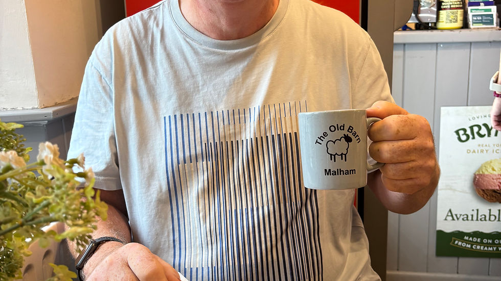
Arriving back at the village, it's time for quick refreshments, and there are a few places to choose from. We opted for soup and coffee at The Old Barn and thoroughly enjoyed it.

The total walk was about 4.5 miles with an elevation gain of 820 feet. It took around 3 hours, as we took the first half slowly, admiring the surrounding countryside and then treading carefully over the slippery limestone.

Staying overnight in the Yorkshire Dales, we chose an Airbnb called The Cow Shed near Skipton at Embsay. It wasn't actually part of a farm; it was a room above a garage in a modern house. The room was beautifully decorated and had everything you needed, including a small kitchen and ensuite. There was even a welcome pack with water, crisps, and biscuits.


In the evening, we had booked to go out for dinner back in Malham at Beck Hall, a fully vegan hotel. The rain was pouring, but we dressed up to go out and enjoyed a Sunday roast with chilled wine and beer. Tomorrow would bring a new view and a new village.


Hawes
Leaving the Airbnb in Embsay, we drove through gorgeous countryside, passing through Kettlewell, Buckden, and Oughtershaw. Our destination was Hawes, a traditional market town, the highest in England, with lots of independent shops and cafes. It provides a great base for exploring and is famous for Wensleydale cheese.
We only had half a day here, but close by is England's largest single-drop waterfall, called Hardraw Force, and the famous Ribblehead Viaduct. There is also a circular walk around Hawes that is 11 miles long, which can be completed in shorter sections.


We opted to have brunch at the Penny Garth Cafe, then had to leave to return home. We honestly didn't want to go, as there is so much to see and do in the Dales. We made a commitment to return very soon, armed with our No Fuss Travel Guide. (This is not a paid promotion).


So, if you have 36 hours in the Yorkshire Dales, this is the best hike and places to visit. Staying overnight was a great decision. The sense of well-being after being exposed to such stunning scenery and hiking, even in changeable weather, was incredibly beneficial. Being spontaneous and making the most of every day is what retirement is all about.
If you like what we do, please consider subscribing to our monthly email to stay updated. Also, feel free to leave us a comment, a like, or share the love with your friends and family.
Thank you,
Karen and Michael
2 On Tour Explore

Comments